

Whenever a ship can moor at a jetty or a quay using mooring lines, the process of replenishing a ship’s water is simplified. All that is required are for water pipes to be laid along the wharf. Difficulties abound whenever there is a lack of such facilities, but these hassles are always mitigated or overcome whenever entrepreneurs abound.
This blog deals with these entrepreneurs and their solutions.
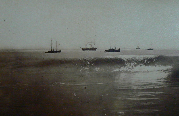
Main picture: Port Elizabeth From South End, painted by Baines in 1853, [Transnet Heritage Library N58606]
The French sailing ship: Le Necessaire
Historically, French naval vessels, like other sailing ships, primarily carried water in wooden barrels (also called casks, butts, or hogsheads) stored in the ship’s hold.
During extended voyage’s especially when sailing in enemy controlled waters, the collection of water from the shore was frowned upon as being too dangerous. Instead the sailors would rely upon rain squalls for water collection. In this case sailors would spread out sails to funnel rainwater into buckets and then decant it into casks. Even though the water could pick up a “unique” flavour from the oiled canvas, beggars could not be choosers.

The saga of the Le Necessaire highlights the consequences of obtaining water ashore especially when in enemy territory. During February 1752 the French sloop, the Le Necessaire together with two other vessels departed from the French Island of Mauritius with the objective of examining the southeast coast of southern Africa. They would have been aware of a Dutch settlement at Cape Town but were unsure of whether the Dutch were claiming or operating from any other portion of this vacant land.
It is presumed that the French squadron sailed steadily southward checking for human activities. With none visible, and being short of water, the French concluded that it was safe to land small boats to collect water. The location selected was the feeble stream called Shark River, now Happy Valley. In the process, the boat overturned in the surf, disgorging its nine occupants. In the meanwhile, a storm had steadily arisen overturning the small boat in the surf and forcing the Le Necessaire to withdraw to deeper water in order to prevent it from being driven onto the rocks on the shore further south.
Fully expecting their mother ship to return once the storm had abated, these French seamen were probably initially unperturbed by the withdrawal of their “home”, the Le Necessaire. The first hints of probable abandonment were possibly raised sotto voce the following day. With the full retreat of the stormy weather, which was presumably replaced by a vivid blue sky, expectations of their imminent rescue ran high. No record of what actually happened has survived but one can presume that those less sanguine silently explored their surroundings for food. In all likelihood, fish trapped in the blind Shark River were all that could be found.
Initially the expectations of being rescued would have high but after several more days of clear weather, the mood of the men would have would switched from expectant becoming morose and demoralised as the full impact of their abandonment by the Le Necessaire became abundantly clear. Comprehending the gravity of their situation, they would have set off to the closest town, Cape Town, 800 kilometres away. In reality they only would have had to survive the 398kms to Mossel Bay as in 1792 this was the eastern border of the Cape colony. The only objects that they bore were a musket and two pistols and possibly some water caskets. Apart from their practical use to carry water, these casks could be used in a barter transaction with the indigenous Khoikhoi or Hottentots as they were locally known.
No record survives of these nine men’s travails, but it is safe to assume that they would have begged, borrowed and stolen supplies off the local khoikhoi en route to survive. In reality they would only have to survive the 368kms to Mossel Bay as in 1792 this was the eastern border of the Cape Colony. Nonetheless it was still a formidable target.
John Barrow’s observation
During 1797 John Barrow noted how ships in that era ships replenished their water supplies in the Bay. As there were no jetties at that stage, Barrow noted that “copious amounts of fresh water were to be obtained from a spring which lay close to the landing place just below a hill overlooking the mouth of a small river. Sailors floated the barrrels in and out of the surf.” This rivulet was presumably the Baakens River. Further Barrow noted that “This was a hazardous business even at the best of times.“
The first piped water supply
On page 98 of his thesis on the development of the harbour in Port Elizabeth, Jon Inggs includes this comment regarding Fortuin: “The only other improvement to port facilities during this period [1820s] was the provision of water to ships by a Malay, Fortuin Weys. He erected a pump and laid pipes from it to the landing beach.

Harradine describes the first enterprise of this kind by Fortuin Weys 1829 as “a pump to pipe water to the sea’s edge from a well in Market Square.”
By 1834 Weys was described by Thomas Pringle as “one of the wealthiest and most respectable inhabitants of the place’. He had originally been granted land at Algoa Bay in March 1820. By the time the settlers landed, his house, still under construction, was the second substantial one to be built at what was soon to become Port Elizabeth. He was listed as a blacksmith by Griffin Hawkins in 1822. In time he acquired a number of properties in the town and further afield”.
Later piped water scheme
In his thesis Jon Inggs notes that the next development in the water supply business, was the “formation of the Algoa Bay Mooring and Watering Company in September 1850.” According to Harradine it was only during April of the following year that the Company commenced operations. The reason for this delay was because it experienced “an impure water problem.” To rectify it, rights were secured to a supply of water from south of the Baakens River. A large tank was built over the springs on the south side of the Baakens River and piping carried the water beyond the surf to a water boat from which ships could be supplied.
Twelve tons of water could be loaded into their waterboat in 30 minutes. This in turn could be pumped into a ship in 40 minutes. The service “did away with necessity of loading casks.”. In October 1851, the Company was able to provide H..M.S. Rhadamanthus with 27 tons of water. Based upon this performance, local commentators reckoned that the provision of water would become the port’s first permanent facility.
The hulk of an old wrecked ship stripped of its fittings and permanently moored, was utilised as storage space for items to be used by ships in trouble. In this case, the hulk housed a supply of cables and anchors. In the case of the gale over the 15th and 16th October 1850, the hulk had the necessary equipment but no requests were made for its use resulting in the loss of three shipsviz the Doris, the John Witt and the Mary Ann.
Vandalisation
The successful inception of operations created a positive vibe throughout the town. Speculation abounded regarding what other services would shortly be offered. Instead of elation there was dejection. Malicious irresponsible actions by vandals had popped the bubble. During the night they had turned on the watercock and drained the whole tank . On the subsequent night they had “Besmeared the whole boat”
The company soon abandoned its mooring business. During November 1851 the hulk and its fittings was offered for sale. For these and other reasons, the company experienced a faltering start, finally being wound up in 1857
. In December 1857 a stone tank was built over the spring and the old wooden tank was removed.
By November the Company’s waterworks had been inspected and certified by the Government Engineer, George Pilkington, who was favourably impressed. An iron pipeline ran out beyond the surfline from the reservoir south of the Baakens.
Era of the jetties
The construction of the North Jetty did not relieve the situation as moorings were restricted to small vessels. Larger ships had to be serviced while at the roadstead with lighters ferrying goods between South Jetty and the vessel at anchor.
Water storage and quality
Onboard Storage: Large quantities of fresh water were loaded into wooden barrels before a voyage. These were often stored in the lower parts of the ship to serve as necessary ballast.
Water Quality: The water often became stagnant, foul-smelling, and a breeding ground for algae and microorganisms after a few weeks at sea, especially in warmer climates. To make it more palatable and to inhibit bacterial growth, it was often mixed with alcohol (wine in the French navy, or later rum, which created grog).
Replenishment: Ships relied heavily on stopping at ports or suitable landfalls such as islands with streams or springs in which to empty, clean and refill their barrels.
Early distillation
By the mid-18th century, some ships, including the HMS Victory had small sills attached to a galley stove that could distill small quantities of freshwater from sea water. However, this method only produced limited quantities e.g. 9 litres per day on a large vessel and was reserved for the sick bay. It was never a primary source of water for the entire crew due to the large quantities of wood fuel required
Later innovations
The widespread use of efficient distillation apparatus such as the French designed jet condensor only became practical with the advent of steamships in the 19th century, which had ample waste heat available from their boilers.
In essence, carrying sufficient fresh water was a constant struggle and a major limiting factor for long voyages during the age of sail.
Sources
Liverpool of the Cape: Port Elizabeth Harbour Development by E. Jon Inggs
Algoa Bay in the Age of Sail -1488-1917 – A Maritime Story by Colin Urquhart Bluecliff Publishing, Port Elizabeth


