

With shades of Einstein’s relativity of time and distance dilation at high speeds, what relevance does this seemingly illogical question relating time and distance have to the Port Elizabeth of Yore blog. Patience dear reader, all will be revealed.
Robert Jacob Gordon executed many expeditions into the interior of the Cape Colony. Of particular interest to Port Elizabeth is his second expedition when he swung through the Algoa Bay area from the 15 th to the 23 rd of January 1778. He was taken to the wreck site of the Sacramento where those who could not make the trek up to Delagoa Bay were buried. He also produced two huge panoramas encompassing the sweep of Algoa Bay, one from near the mouth of the Coega river and another from a high point in the Kragga Kamma area.
Main picture: Panorama of Algoa Bay in 1778 by Robert Gordon
However, when reading his journals to try to work out where he was or where geographic features are located, all his distances are quoted in hours. This obviously refers to the distance that can be covered in an hour, but does it refer to a man walking or a horse walking or trotting? They also seem a bit arbitrary and imprecise. This perplexed the author until a Frederici map from 1790 era was found that stated the relationship between roods and hours above the scale: Schaal van 9000 Rhynlandze Roeden of ses Uuren gaans (Scale of 9000 Rhineland Roods or six hours travelled).
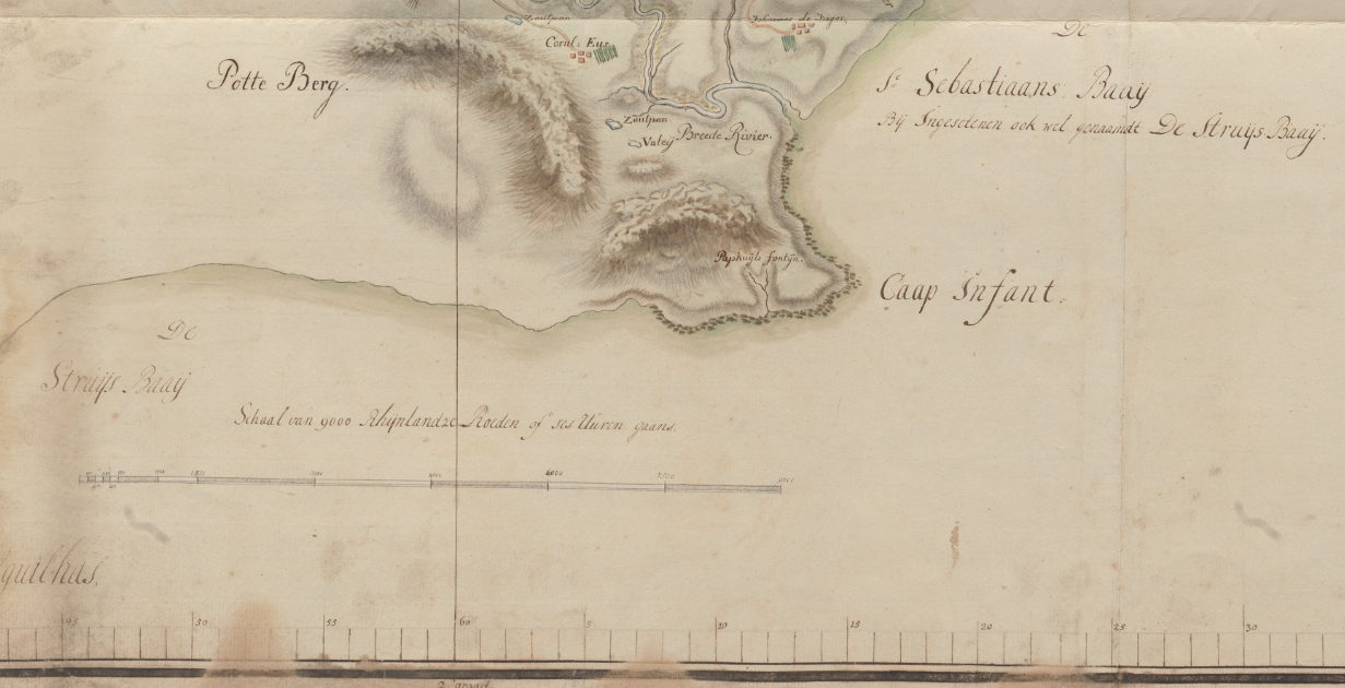
Left: Frederici’s map of 1790
So now we know that 1 hour = 1500 Rhineland Roods. The next problem is how far is a Rhineland Rood as the definition varied over time and region. Thanks to Google Maps it was a simple case of measuring the distance between two widely separated and well-defined points on the old and new mapping systems and comparing.
The upshot of it all is the distance of 1hr using this map as a basis is 6.8km.